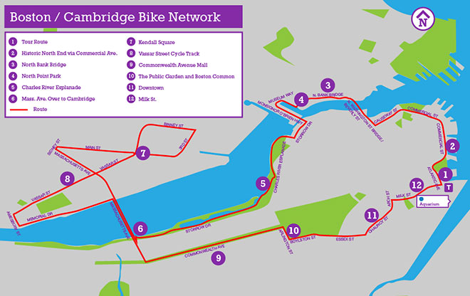
Tour Route
This 10-mile tour begins at the Aquarium in Boston, which is a convenient place to get a Hubway Bike or to rent a bike from Urban AdvenTours. This location is accessible via the MBTA Blue Line. This area has been completely transformed by the removal of an elevated freeway that used to cut off the waterfront from downtown. It has become one of Boston’s busiest tourist areas. Be sure to visit Central Wharf Plaza, Christopher Columbus Park, and the Rose Kennedy Greenway.
Image: Jennifer Toole 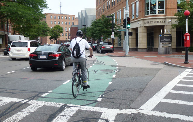
Historic North End via Commercial Ave.
Head north on Atlantic Avenue in the bike lane and take the first right (also Atlantic Avenue) and follow it through Boston’s North End, former home of Paul Revere and the heart of Boston’s historic Italian neighborhood. Commercial Avenue has a continuous bike lane with green pavement to indicate areas where motor vehicles merge across the bike lane. In the past, an elevated train ran above this street -- it was made bikeable by narrowing the other travel lanes to make room for bike lanes.
Image: Jennifer Toole 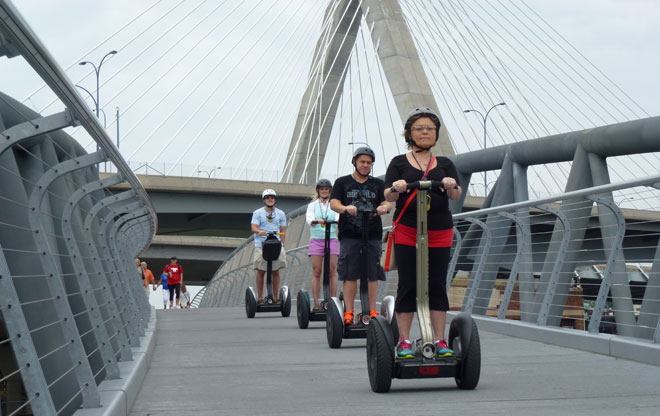
North Bank Bridge
Continue straight on Causeway Street at the N. Washington Street Bridge and turn right at the Beverly Street Extension. Continue to the end of Beverly Street and walk your bike along the pathway over the locks. As you exit the locks, turn left on the pathway through Paul Revere Park and head towards the beautiful North Bank Bridge. This 690-ft bicycle and pedestrian bridge was completed in 2012 and was funded as a part of the “Big Dig.”
Image: Jennifer Toole 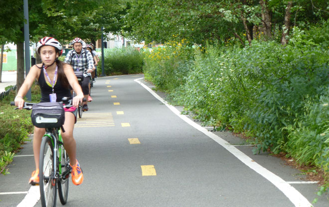
North Point Park
After crossing the bridge, you will pass through Cambridge’s North Point Park, which is an excellent place for a rest stop. This is an good example of a park that integrates a continuous bikeway. Pedestrian crossings along the bikeway are defined by pavement markings and are channeled to certain locations by berms and planting beds. When you get to Museum Way, take a left, and then another left onto Monsignor O’Brien Highway. This is a busy road, you may prefer to stay on the sidewalk.
Image: Jennifer Toole 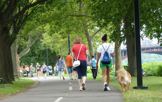
Charles River Esplanade
Take a right at Storrow Drive to access the Charles River Esplanade. The esplanade is one of Boston’s most active spaces, loved by bike commuters and joggers alike. There are multiple pathways (including the Paul Dudley White Bike Path) within the esplanade to choose from. For a more scenic route, turn right at the ball field and weave your way to the right towards the path alongside the river. Remember to yield to pedestrians and give an audible signal when passing.
Image: Jennifer Toole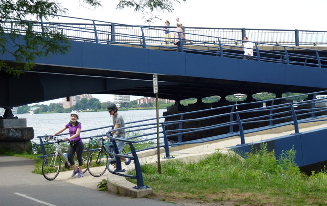
Mass. Ave Over to Cambridge
Use the ramped walkway to get up to the Massachusetts Avenue Bridge. This is a good example of something all bike-friendly cities provide: easy access between riverside trails and bridges. You can either ride in the bike lane or use the sidewalk to head back over the river into Cambridge. Follow the bike lanes along Massachusetts Avenue and take a right on Sydney Street. Or, if you are feeling adventurous, continue up Massachusetts and visit Harvard Square.
Image: Jennifer Toole 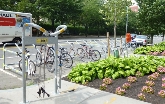
Kendall Square
Turn right on Main Street and ride through the heart of MIT’s campus to Kendall Square. This area is transforming into a multi-modal hub. By building a strong bicycle, pedestrian, and transit network, Kendall Square has accommodated millions of square feet of new office, housing, and retail space with minimal parking. Take a left on 3rd Street to see one of Cambridge’s first bike corrals, which was created by removing parking spaces. Need some air? Check out the Fix-It station next to the corral.
Image: Jennifer Toole 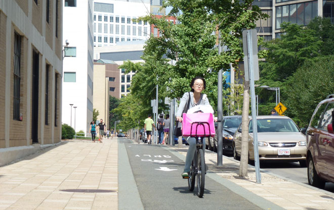
Vassar Street Cycle Track
Continue north on 3rd Street and take a left at Binney Street. Cross Massachusetts Avenue and continue south on Vassar Street, which is one of the nation’s first cycle tracks. It was built by MIT in cooperation with Cambridge to accommodate and encourage bike travel through campus. This cycle track is one-way on each side of the road. Areas where vehicles merge across the pathway are marked with blue paint. You may want to pause along the way to admire the architecture.
Image: Jennifer Toole 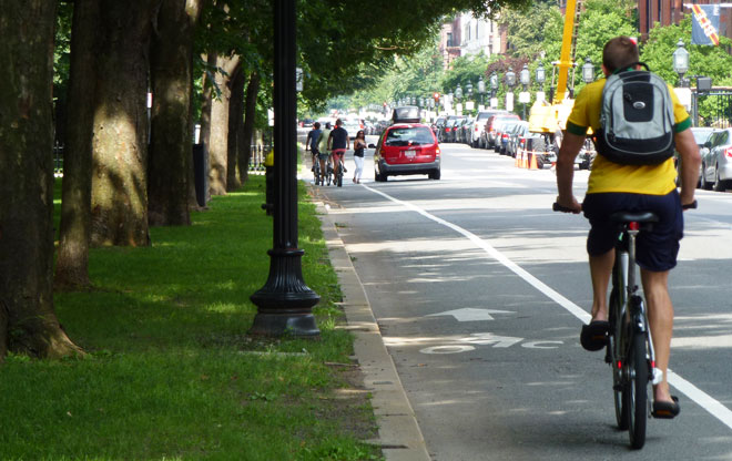
Commonwealth Avenue Mall
At the end of Vassar Street, head back north on the path along Memorial Drive. Take a right on Massachusetts Avenue and go back over the bridge into Boston. Hang a left at Commonwealth and travel along this leafy, historic boulevard. This is a key connection in Boston’s bike network. The bike lane is on the left side to avoid conflicts with car doors, taxis, and other vehicles stopping on the right. Green bike boxes help bicyclists position themselves for turns at some intersections.
Image: Jennifer Toole 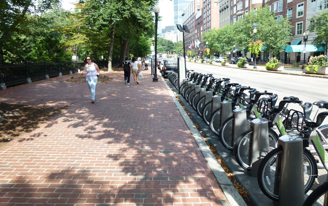
The Public Garden and Boston Common
At the end of Commonwealth Avenue, turn right onto Arlington Street and stay in the far left-hand lane to take a left onto Boylston. Getting around this part of town on a bicycle is a challenge (the city has plans to improve this connection). If you don’t feel comfortable riding in traffic, this is a good place to dismount your bike and walk along the sidewalk. Check out the Hubway station at the corner of Boylston and Arlington streets.
Image: Jennifer Toole 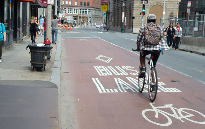
Downtown
Continue east on Boylston Street, which becomes Essex Street. Take a left on Chauncy Street and proceed to the red bus-bike lane on the left-hand side of the street. Boston’s downtown streets are notoriously narrow; space is at a premium. On many downtown streets, shared lane markings remind motorists to expect bicyclists. Traffic is generally slow, which makes bicycling easier. Turn right at Summer Street, left onto Arch Street, and right on Milk Street. Continue along Milk Street back to Atlantic Avenue.
Image: Jennifer Toole