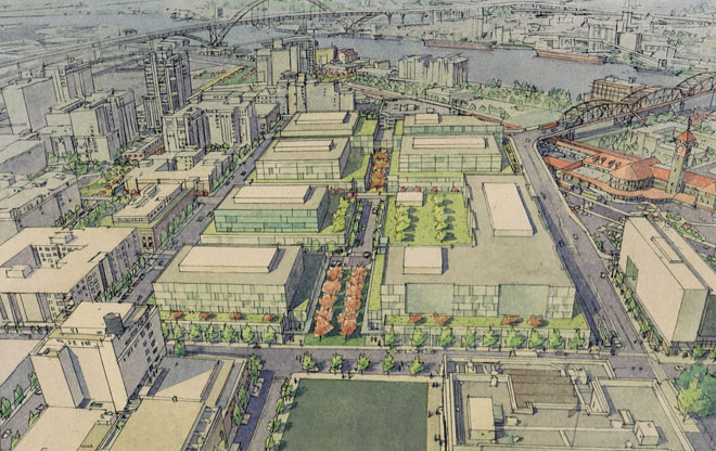
U.S. Post Office Site
To ensure job growth, we must continue to develop the Westside employment districts. These districts include the Downtown core, University District, Pearl District, and Old Town/Chinatown. They can serve as potential headquarters for companies as well as locations for clustering like-minded smaller companies. One example of a potential job center is the 13-acre U.S. Post Office site, the largest contiguous parcel in downtown. No redevelopment action imminent.
Image: LLoyd Lindley for Portland Development Commission, Ilustration by Craig Holmes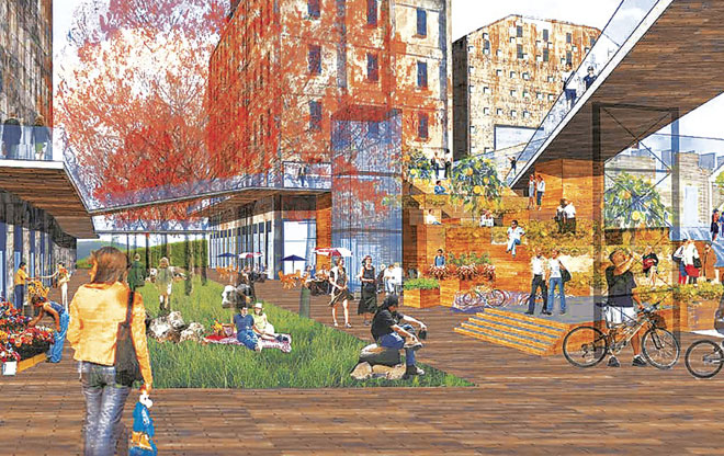
Centennial Mills
Centennial Mills was in operation until 2000, when the Portland Development Commission purchased the property. The commission intended to clear the site for a public park, but community backlash led to the preservation of most of the property. While most buildings will remain intact, plans call for a warehouse in the center of the 4.75-acre site to be demolished, clearing space for an entryway, while portions of two other warehouses along the river’s edge will be removed to make room for public space along the wharf.
Image: Portland Development Commission and the DJC, Oregon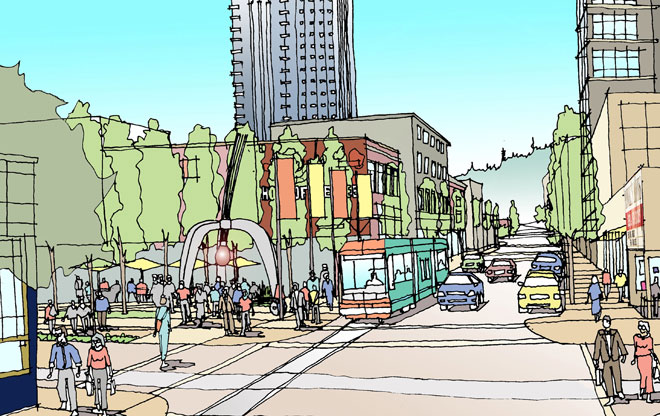
Burnside Streetcar
Burnside is the east and west meridian of the city. The Burnside/Couch Project envisioned a streetcar line running from Washington Park and NW 24th Place through the heart of Portland's Central City, eastward across the Willamette River, turning onto Sandy Boulevard. This streetcar route would have the greatest modal interchange of any line in the city, connecting with Portland's award-winning transit mall (bus and MAX), streetcar on Martin Luther King Boulevard and Grand Avenue, and the Airport Max line.
Image: Lloyd Lindley 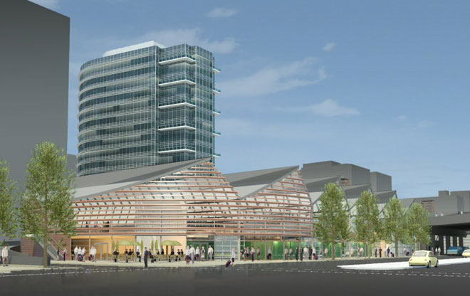
James Beard Public Market
In 2016, the James Beard Public Market, a fantastic year-round, indoor-outdoor marketplace, will open. The market, named in honor of the Oregon-born “dean of American cookery,” will be located at the west end of the Morrison Bridge in downtown Portland and feature more than 50 permanent vendors, 40 day tables, full-service restaurants, a teaching kitchen, and event space.
Image: SERA Architects 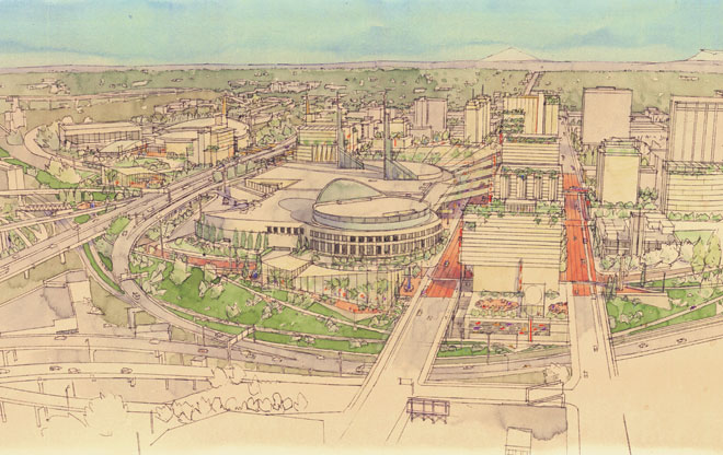
Oregon Convention Center Area
The Oregon Convention Center and The Rose Garden are entertainment venues next to each other. The surrounding district is the second-largest employment area in the state and is ripe with potential. Mayer/Reed was part of a multi-disciplinary team studying ways to establish a vital entertainment district and mixed-use neighborhood in the area’s sixteen blocks. The goal is an urban design plan to catalyze re-development. Meeting the city’s sustainability goals -- adding in parks and open space, plazas, streetscapes, and pedestrian routes – is key.
Image: Portland Development Commission. Illustration by Craig Holmes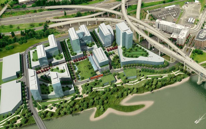
OHSU South Waterfront Campus
Much of Oregon Health & Science University’s growth will occur on 26 acres the university owns in the South Waterfront district. In 2008, the university drafted the Schnitzer Campus Strategic Framework Plan. The plan provides a horizontal framework for the placement of streets, parking, utilities, open space, pedestrian connections, and future building sites. OHSU envisions a campus with approximately two million square feet of building space.
Image: ZGF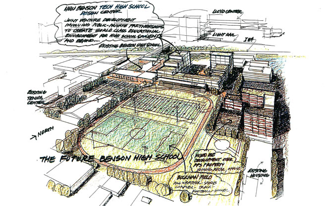
Benson Design Center
This is an early representation of what a new Benson Design Center might look like. Pending bond passage, development could start in 2016. The center aims to meet the growing needs of Oregon’s future workforce. The center could offer courses in architecture; engineering; and urban, landscape, product, interior, and even fashion design. The center can help the city meet the needs of the growing creative class, which is increasingly responsible for the economic vitality of Portland and the entire Pacific Northwest.
Image: Group Mackenzie 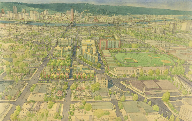
12th Sandy Burnside
On the east side is a future development opportunity envisioned to link the Kerns and Buckman neighborhoods. In 2005, I prepared a development strategy that led to 2010 improvements to the 12th, Sandy, and Burnside intersection. Pedestrian and bike-friendly connections liberated two new city blocks, enabling the assemblage of five blocks. East Burnside has become a hip destination for retail shopping, dining out, and clubbing. New blocks would support this burgeoning area, providing additional housing and employment opportunities.
Image: Lloyd Lindley for the Portland Development Commission. Illustration by Craig Holmes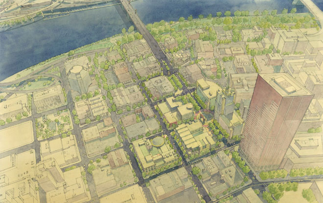
Lower West Burnside
This area is among the most blighted, yet it symbolically links the east and west sides of the Willamette River and is at the heart of Portland’s night life, Saturday Market, and Tom McCall Waterfront Park. Redevelopment has been stalled for years due to lack of access and a poor pedestrian environment. The 2005 Burnside/Couch Project envisioned remaking this area into a vibrant, pedestrian and bike-friendly, mixed-use place, with a fashion and design district, promenade, and festival streets, all reinforced by renovated properties and new infill.
Image: Lloyd Lindley for the Portland Development Commission. Illustration by Craig Holmes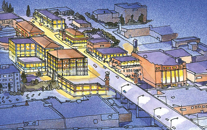
Burnside Bridgehead
The Eastbank at Burnside Development Strategy from 1999 envisioned robust development flanking the Burnside bridgehead. This prominent location would enjoy spectacular views of downtown and Tom McCall Waterfront Park. The strategy envisioned five blocks of redevelopment and renovation, increased pedestrian and bicycle connections to the Eastbank Esplanade, within a pedestrian and bike-friendly environment for Burnside, Couch and Davis streets. A mixed-use mid-rise development is pending.
Image: Lloyd Lindley for the Portland Development Commission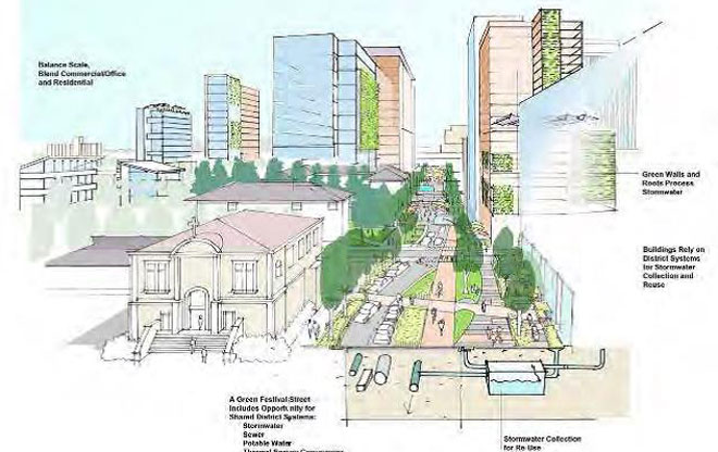
N/NE Quadrant Plan
The N/NE Quadrant is made-up of two central city districts: Lower Albina and the Lloyd District. Lower Albina is an industrial district, with a working harbor area, an important living-wage job base, and a small mixed-use historic area. The Lloyd District hosts the Rose Garden, Oregon Convention Center, a shopping mall, large office buildings, and neighborhood stores. A conceptual rendering illustrates possible high-density development in Central Lloyd, green and open space on the Clackamas, and a better defined street hierarchy.
Image: ZGF for the Portland Bureau of Planning