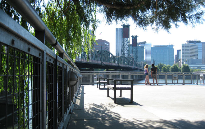
Reflecting Back on Portland’s Skyline
Many visitors arrive by walking or cycling over the historic 1910 Hawthorne Bridge at the south end of the esplanade. The Madison Street plaza provides a scenic overlook for views across the Willamette River to downtown Portland. It’s a place to compare Portland’s two contrasting waterfronts – the grassy expanse of Tom McCall Waterfront Park and the narrow, planted riverbank of the Vera Katz Eastbank Esplanade.
Image: Jean Senechal Biggs 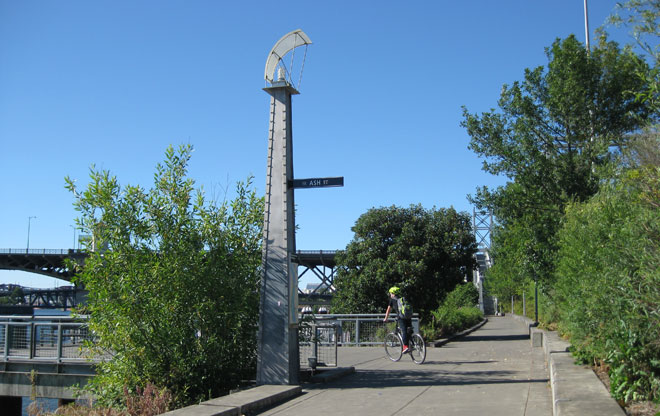
Urban Markers Guide the Way
Urban markers designed by Mayer/Reed provide historical information about Portland’s development and bridges, while being thoroughly contemporary in design. In 13 locations along the esplanade where the street grid used to connect to the river, the 20-foot-tall, stainless-steel markers include street name signs, interpretive displays, maps, and lighting.
Image: Jean Senechal Biggs 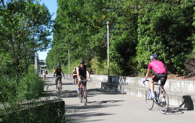
Connections for Cyclists
According to 2010 census data, 6 percent of Portlanders commute by bike – that’s more than 17,000 workers who reap the health benefits of cycling and leave more money in their pockets. The esplanade is a key connection for cyclists and an important link in Portland’s extensive and growing bicycle network. Commuters traveling between Northeast Portland and downtown can choose the esplanade for a stress-free ride without motor vehicles. Weekends are often bustling with families and cyclists of all ages.
Image: Jean Senechal Biggs 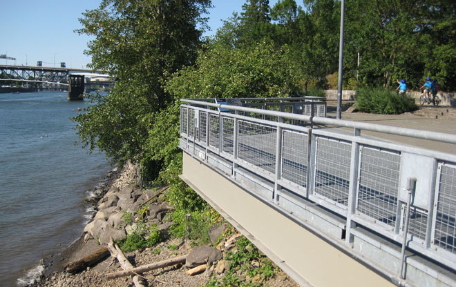
Restoring the Riverbank
The Salmon Street plaza extends to the Willamette River’s edge with a cantilevered steel structure. Here the work of landscape architects made the restored riverbank look natural. Historic development on Portland’s east side filled in areas along the river’s edge with rubble and debris. With the construction of the Eastbank Esplanade, the bank was reshaped and replanted. It now has over 10 years growth, providing shade and creating fish, insect, and bird habitat.
Image: Jean Senechal Biggs 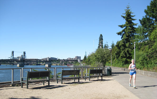
Places for Both Activity and Rest
The esplanade is a place for walking, running, and cycling, but also for rest. Benches provide opportunities to sit away from the activity of the promenade to pause and reflect.
Image: Jean Senechal Biggs 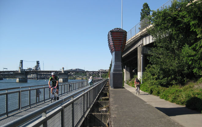
Enriching the Esplanade Through Art
Portland’s Percent for Art program funded four pieces along the esplanade, making one’s experience richer in the discovery of the artworks. The artist group RIGGA collaborated with design team to develop a group of pieces that evoke Portland’s industrial, shipping, and river history. Sitting atop a concrete wall of what once was part of the old Port of Portland terminal is Ghost Ship by James Harrison, a sculpture filled of hundreds of red and orange pieces of art glass that shimmer in the sunshine and are illuminated from within at night.
Image: Jean Senechal Biggs 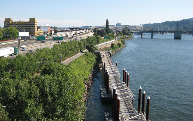
Capturing the Freeway
Construction of Interstate 5 in the 1960s cut off access to the river from the Central Eastside neighborhoods and altered Portland’s relationship with the Willamette River. The esplanade was made possible only through the acquisition of leftover freeway land by the city from the Oregon Department of Transportation. In some places, freeway lanes are about 20 feet away from the esplanade path. Today, a stair tower from the esplanade connects to the sidewalks on the historic Burnside Bridge and provides a view of the river and Interstate 5.
Image: Jean Senechal Biggs 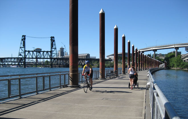
Walk on Water
The 1,200-foot-long floating walkway is the most dramatic experience along the esplanade. The deck is designed to rise and fall with seasonal fluctuations in river levels. It gently moves in the wake of passing boats.
Image: Jean Senechal Biggs 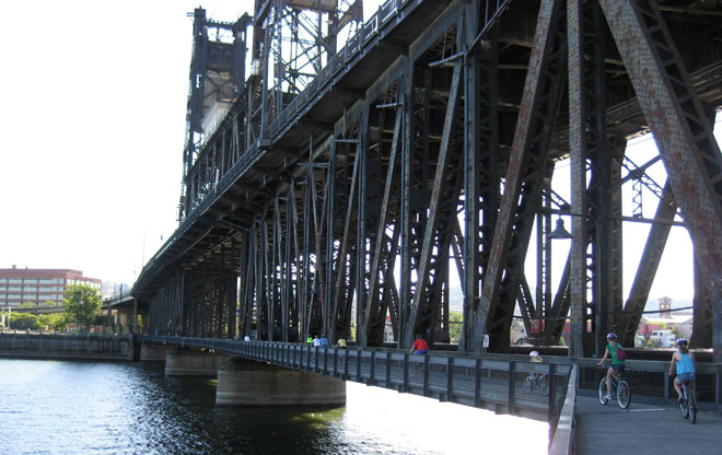
Steel Bridge RiverWalk
At the northern end of the esplanade is a walkway attached to the bottom deck of the Steel Bridge, Portland’s 1912 railroad bridge, which is owned by the Union Pacific Railroad Company. Completed in May 2001 by the Portland Bureau of Transportation, the cantilevered steel structure required meticulous construction to not interfere with the function of the bridge. From here, pedestrians and cyclists can continue on a loop along the west bank of the river through Tom McCall Waterfront Park and into downtown Portland.
Image: Jean Senechal Biggs