Tactile MapTile: working towards inclusive cartography
HONOR
Communications
Jessica Hamilton, Student ASLA | Faculty Advisors: Thaisa Way, ASLA; Anat Caspi; Ben Spenser
University of Washington
Tactile Map Tile
Working towards inclusive categraphy
Photo Credit: Jess Hamilton
Media: Please submit high-resolution image requests to images@asla.org.
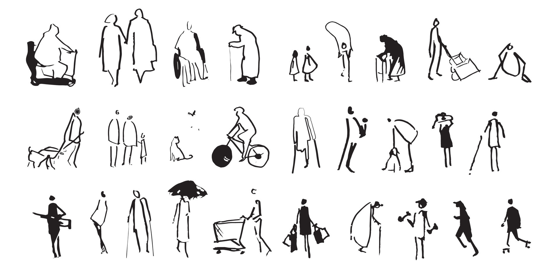
Everyone brings a unique experience to the public realm.
Photo Credit: Jess Hamilton
Media: Please submit high-resolution image requests to images@asla.org.
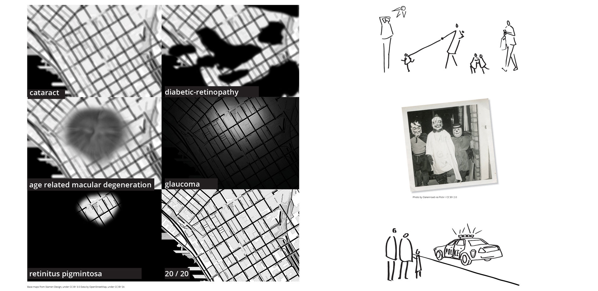
Included in these is a range of visual experiences, from permanent conditions to situational low vision experienced when pedestrian may not be engaged with their surroundings.
Photo Credit: "Last house standing Hurricane Ike" by David J. Phillip-Pool/Getty Images.
Media: Please submit high-resolution image requests to images@asla.org.
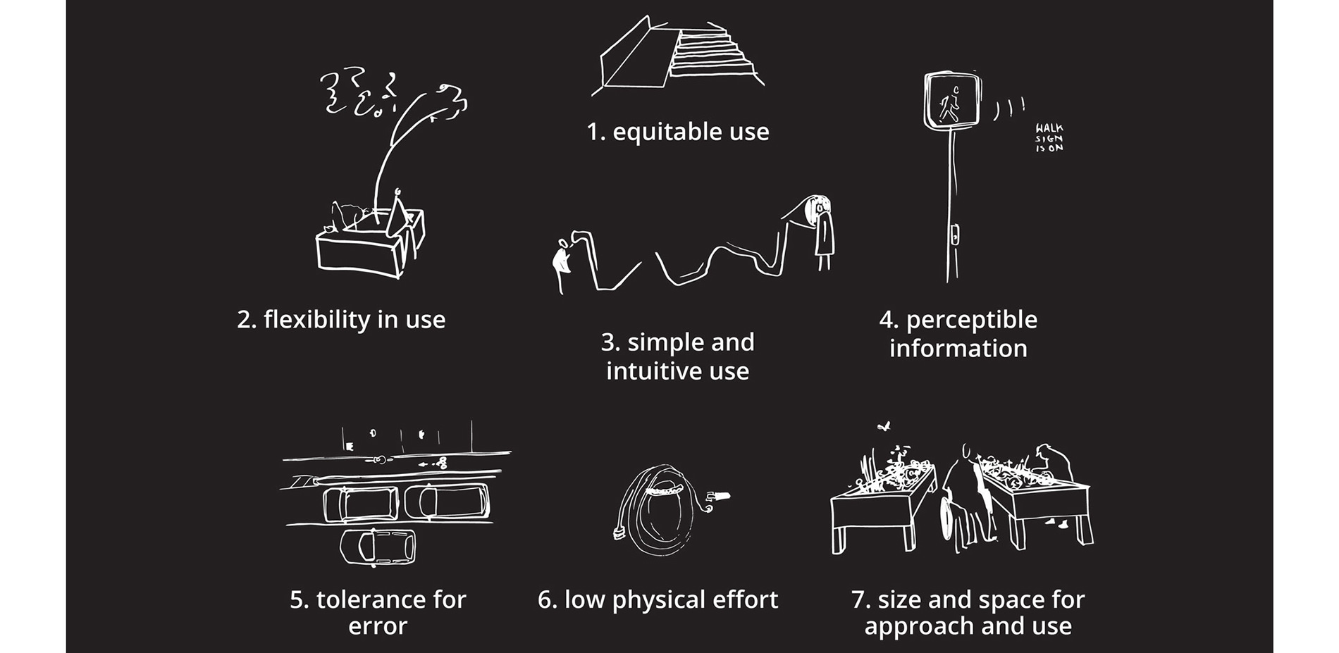
Landscape architecture’s discourse surrounding inclusive and accessible design is largely centered on the Universal Design Principals established at North Carolina State’s Center for Universal Design. A lack of critical engagement with these and related ideas has left significant room for improvement when it comes to equitable design.
Photo Credit: Jess Hamilton
Media: Please submit high-resolution image requests to images@asla.org.
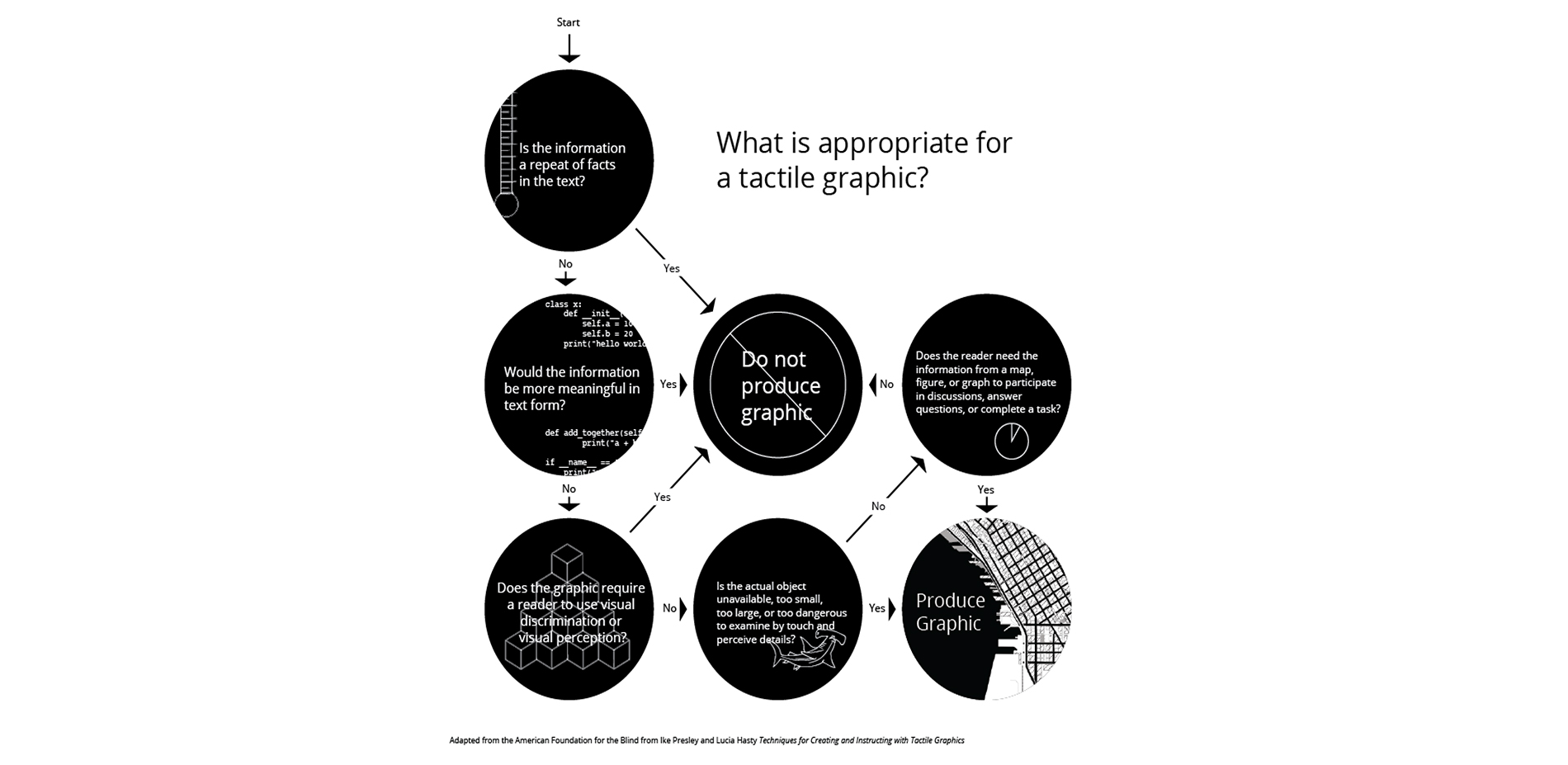
What is appropriate for a tactile graphic?
This project uses the development of tactile graphics as both a means of better understanding the pedestrian experience for people with low vision and blindness, as well as a step towards developing way-finding tools that can be used by people with range of visual experiences
Photo Credit: Jess Hamilton
Media: Please submit high-resolution image requests to images@asla.org.
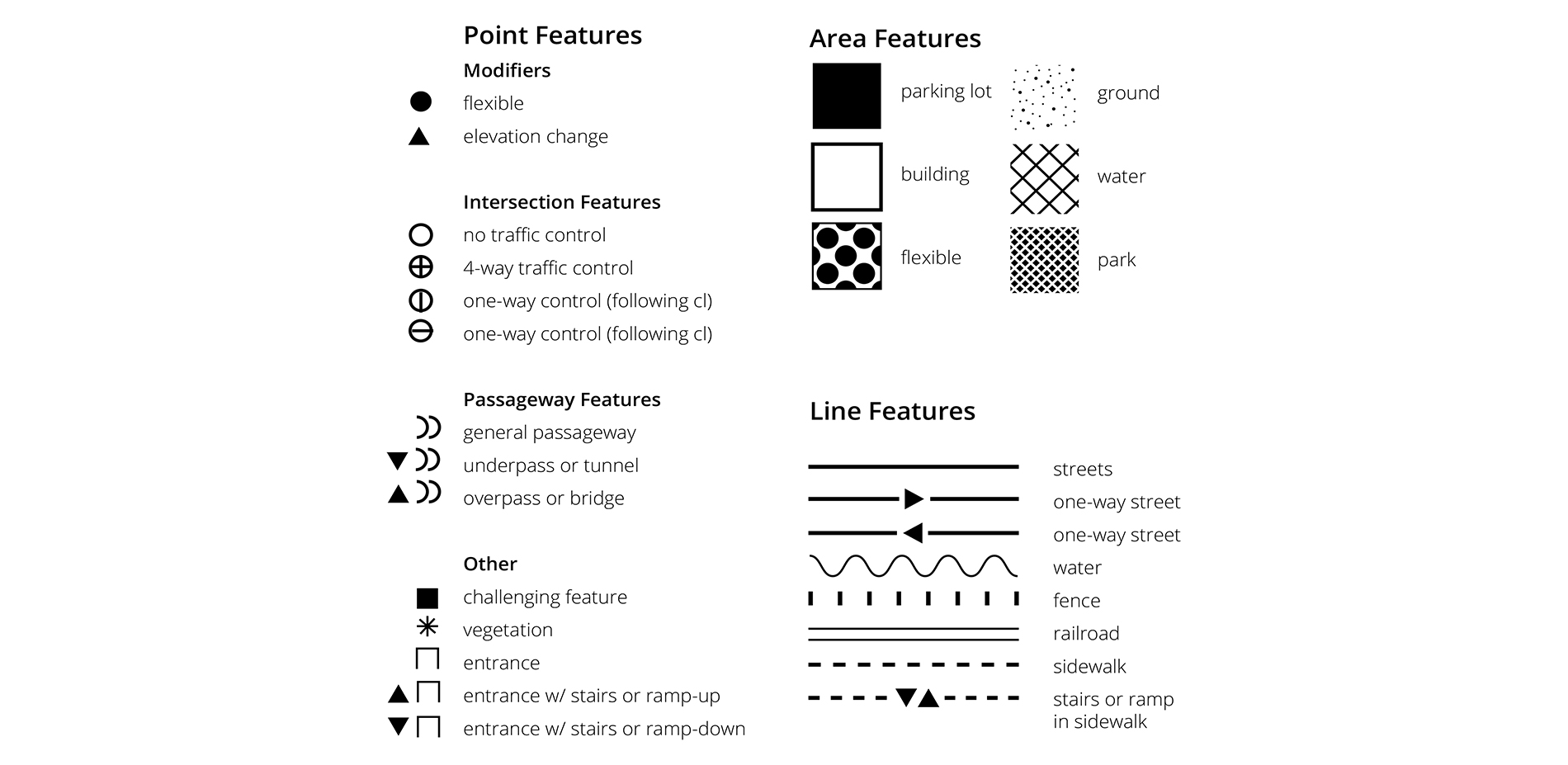
Existing symbology recommended by the North American Braille Authority was developed with braille embossing and micro-capsule paper in mind. Newer 3D printing technologies allow for variable relief heights, which enables a greater range of symbols and extends opportunities for representation.
Photo Credit: Jess Hamilton
Media: Please submit high-resolution image requests to images@asla.org.
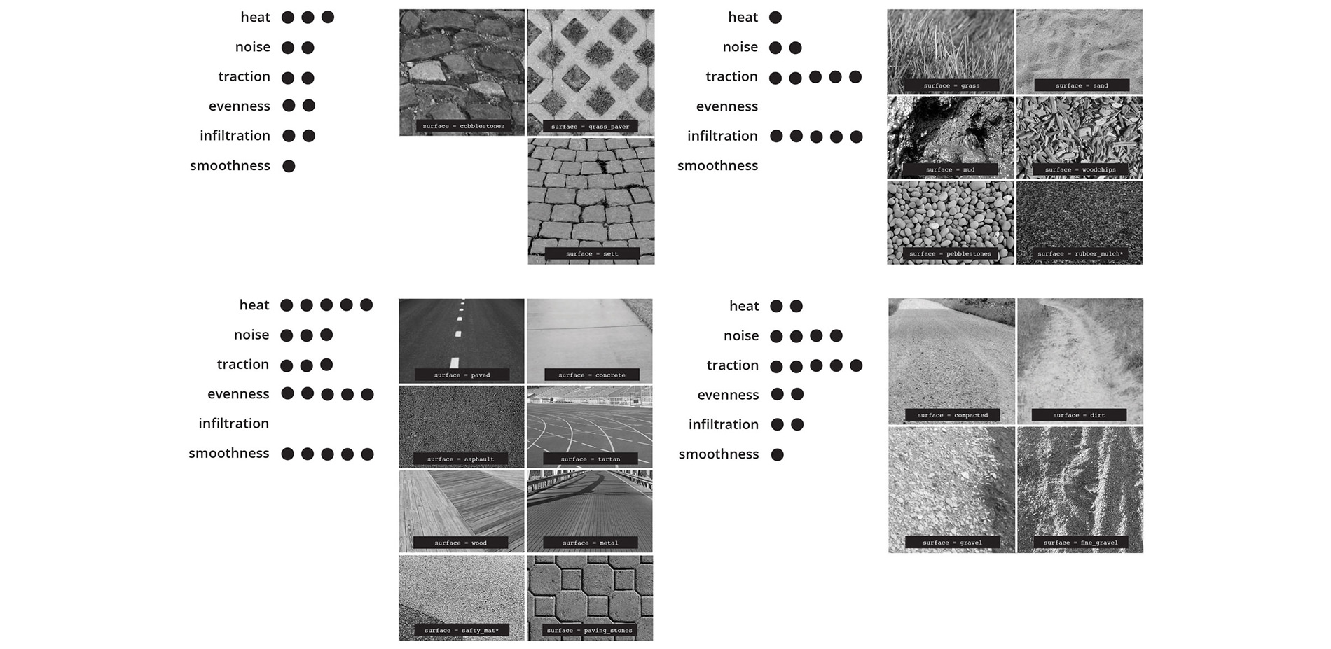
Features of the pedestrian environment were evaluated for inclusion on the maps. Surfaces were grouped according to similar traits in order to reduce the number of symbols required.
Photo Credit: Jess Hamilton
Media: Please submit high-resolution image requests to images@asla.org.
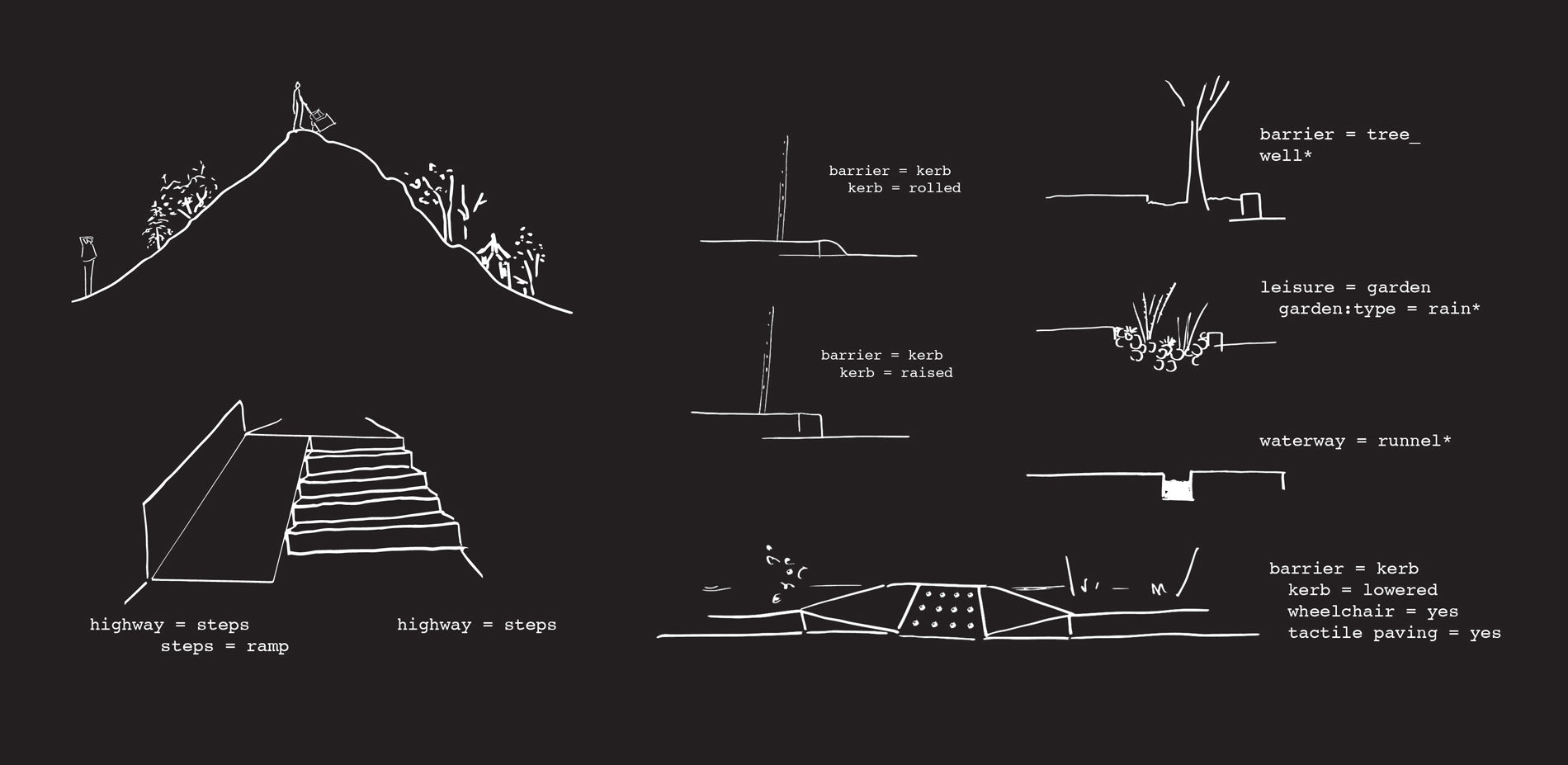
Topography was considered at multiple scales: macro-topography characterizing street or district level grade changes, transitional features such as stairs and ramps, and micro topography changes such as curb heights and tree well depths.
Photo Credit: Jess Hamilton
Media: Please submit high-resolution image requests to images@asla.org.
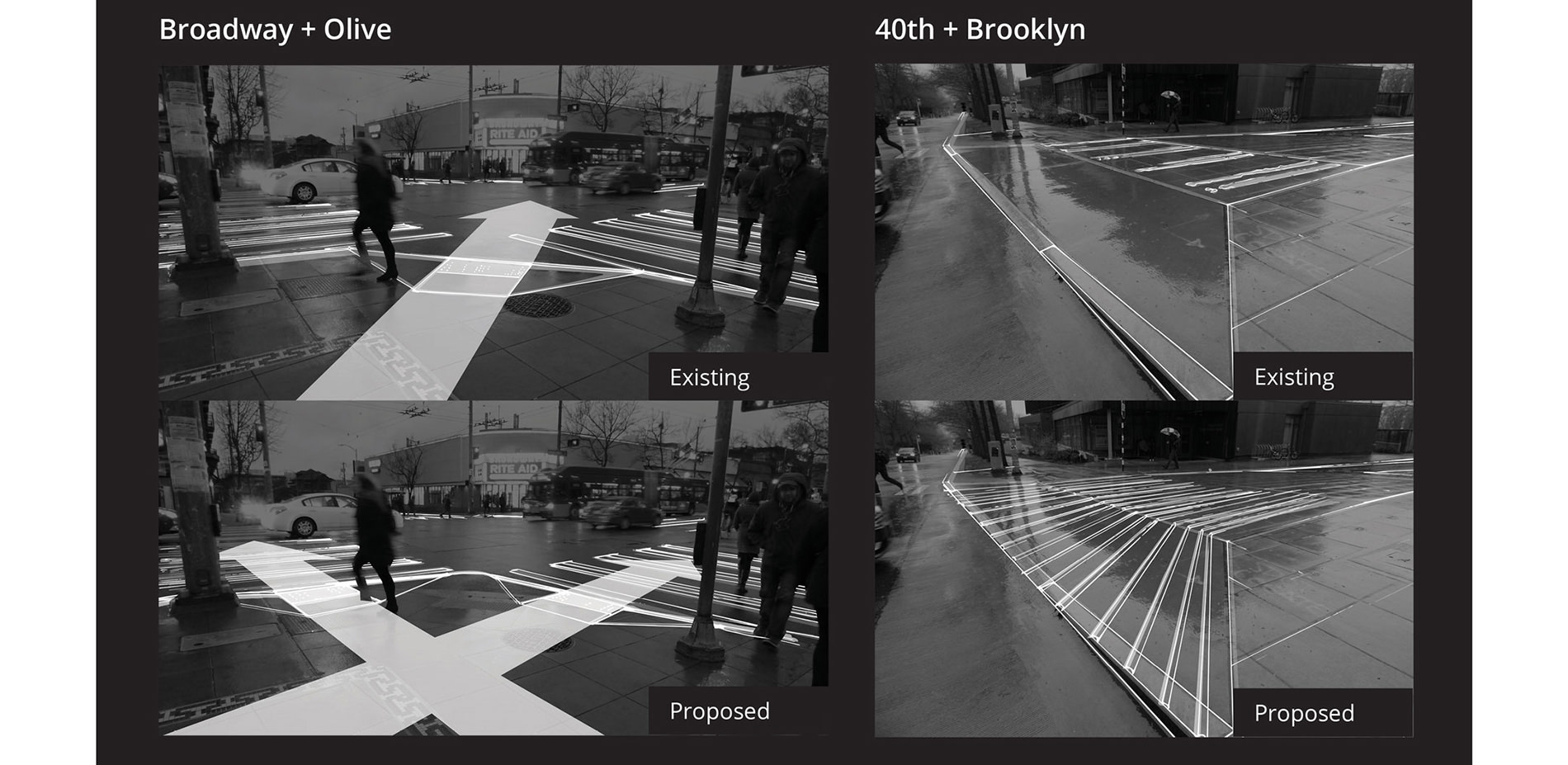
Street interfaces are a critical area for all pedestrians. Curb ramps, with tactile paving suggest transitions and direct heading. Surface, contrast, and grade change all indicate entrance into a car dominant area, and a variety of signal types are used, some more detectable than others.
Photo Credit: Jess Hamilton
Media: Please submit high-resolution image requests to images@asla.org.
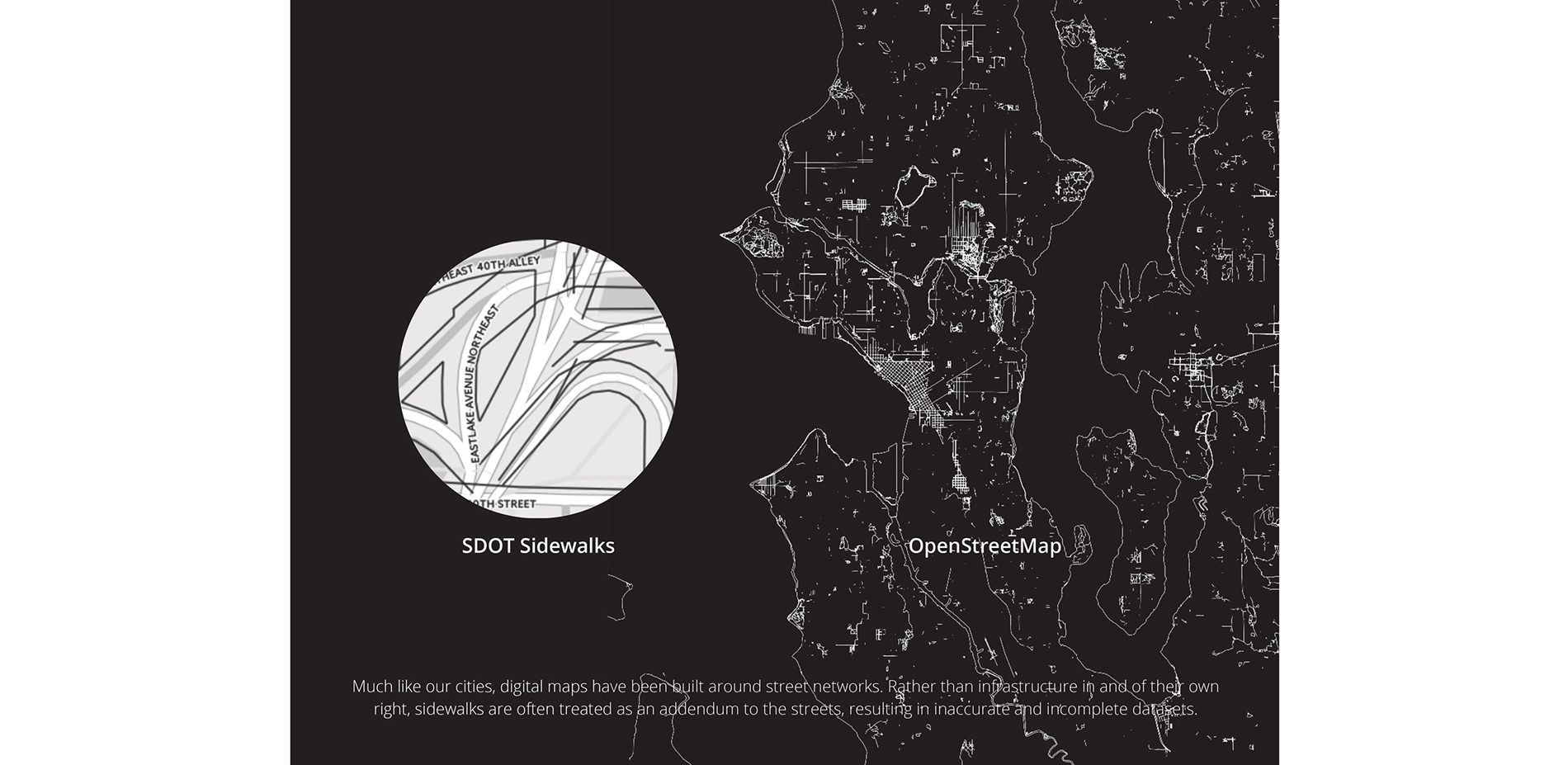
Much like our cities, digital maps have been built around street networks. Rather than infrastructure in and of their own right, sidewalks are often treated as an addendum to the streets, resulting in inaccurate and incomplete datasets
Photo Credit: Jess Hamilton
Media: Please submit high-resolution image requests to images@asla.org.
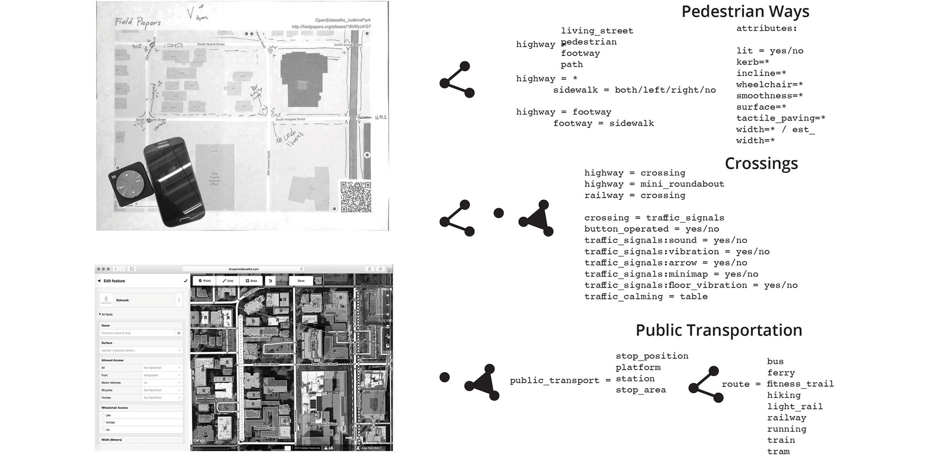
To fill in the data gaps for the area of interest, base maps were printed from fieldpapers.org and manually annotated. After, they were scanned to the OpenSidewalks iD editor and digitally mapped. Passive data collection techniques were also tested.
Photo Credit: Jess Hamilton
Media: Please submit high-resolution image requests to images@asla.org.
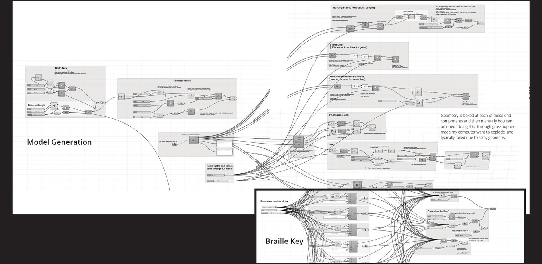
Using the Elk plug-in, OpenStreetMap data is pulled in to Grasshopper to create parametrically designed maps which allow for user feedback, and ever changing open-data sets to be quickly incorporated.
Photo Credit: Jess Hamilton
Media: Please submit high-resolution image requests to images@asla.org.
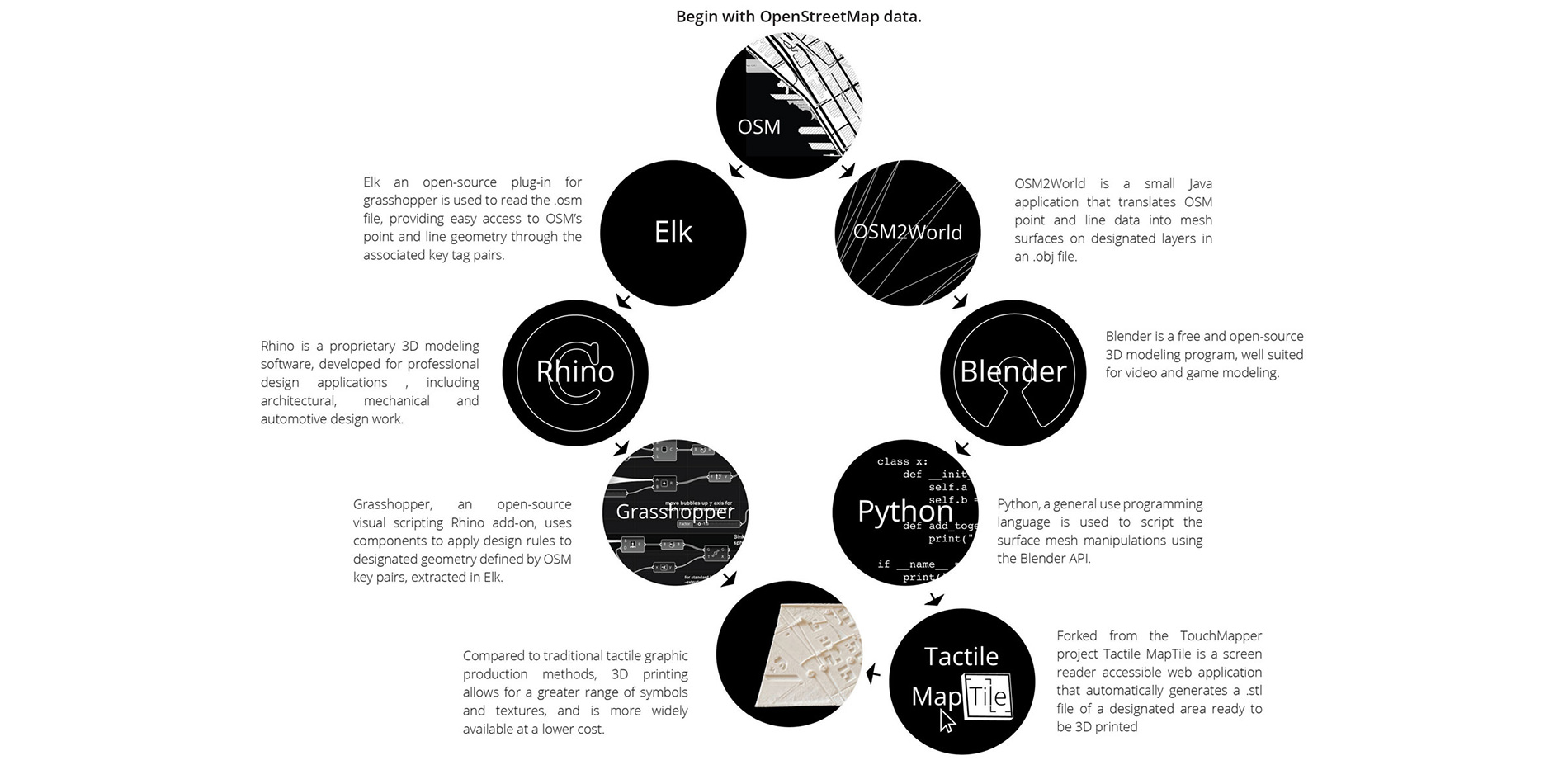
In collaboration with an undergraduate computer science capstone group, an open source pipeline for this workflow was established so that customizable maps could eventually be made available through an accessible web application.
Photo Credit: Jess Hamilton
Media: Please submit high-resolution image requests to images@asla.org.
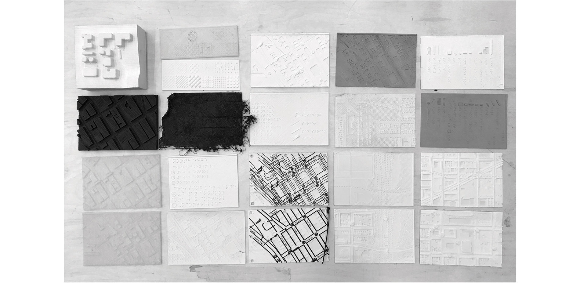
Prototypes were printed throughout the process to test legibility with expert users and to better understand the technical and material constraints associated with 3D printing
Photo Credit: Jess Hamilton
Media: Please submit high-resolution image requests to images@asla.org.
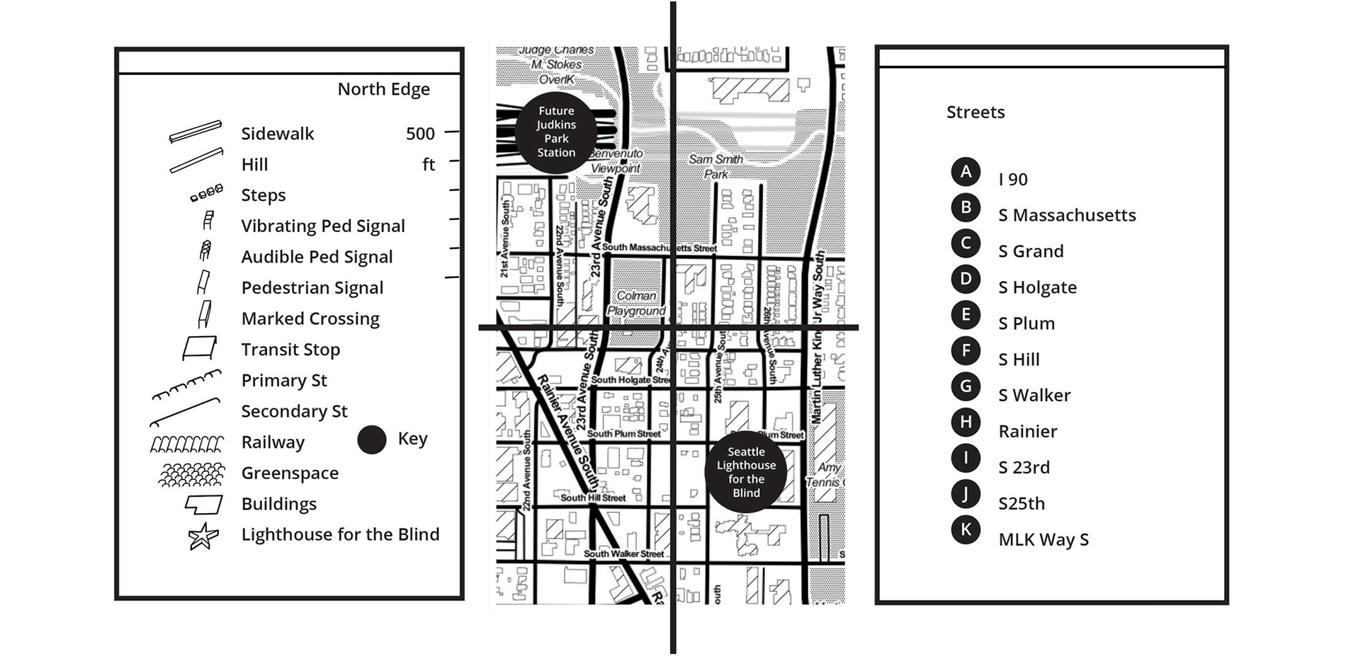
As with any cartographic tool, it is important to include a key, cardinal direction and a scale for clarity. The above graphic keys and map relate to the final area mapped, and braille keys produced.
Photo Credit: Jess Hamilton
Media: Please submit high-resolution image requests to images@asla.org.
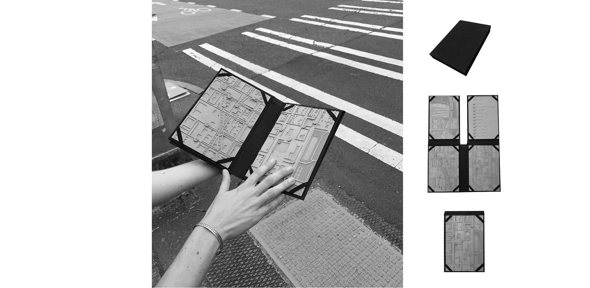
Ultimately the maps were printed using a Wood PLA and sandblasted to achieve a softer texture. A custom folder was bound to organize the map tiles, so they could be used at home prior to a journey, or folded and taken en route.
Photo Credit: Jess Hamilton
Media: Please submit high-resolution image requests to images@asla.org.


A very interesting idea to take what we’re used to with Braille and raised surfaces, put it in a map form, and then into a transportable tool easily carried into the field.
- 2017 Awards Jury
PROJECT CREDITS
- Taskar Center For Accessible Technology
PROJECT STATEMENT
This project presents an alternative approach to exploring the pedestrian experience. Challenging the existing primacy afforded to vision, this work takes a tactile approach. Tactile abstractions are used as a means to guide people through the multi-sensory environments encountered everyday. Designed as tools that enhance spatial understanding for people within a large range of visual capacities, these maps consider circumstances that influence a full spectrum of experience.
Pairing a participatory, data-driven design approach together with interdisciplinary collaboration, these 3D printed, parametrically designed maps allow for user feedback, and ever changing open-data sets to be quickly incorporated.
PROJECT NARRATIVE
Tactile maps are not new to the cartographic record. Their value in facilitating orientation and navigation for the low vision and blind communities has been well established. However, their scope and availability has been greatly limited in the past by high production costs and limited interest from fields traditionally invested in map making and design. These maps have been designed as tools that enhance spatial understanding for people within a large range of visual capacities. They abstract nonvisual cues from the pedestrian environment and consider circumstances that influence a full spectrum of experience.
In collaboration with a group of computer science students, this project works towards the development of a web application that would allow users to automatically generate a 3D map model of any given area. That model could then be printed at home, brought to a local library, or sent to a 3D printing service for relatively quick and inexpensive map production. Beyond customizable map locations, ultimately the application would allow users to specify different scales and map features that are important to them.
Parametrically designed, these maps allow for user feedback, and ever changing open-data sets to be quickly incorporated. While input from several expert users was incorporated throughout the design process of both the maps and the web application, a formal review of the maps produced thus far will be conducted in early June of 2017 with 10-15 members of Seattle’s deaf-blind community. Participants will be asked for feedback on several map styles, and will also be surveyed on their informational needs and preferences.
This work was directed towards establishing critical pedestrian information that should be included in a base map, and designing a set of associated atomic symbols for that critical information. In order to facilitate the end goal, this project focused on employing open source, crowd contributed, geospatial data from OpenStreetMap.
OpenStreetMap was chosen for it’s extensive global coverage and easily extendable data schema. This platform allows for the project to easily pull from a large existing data pool, while also making it simple enough to fill in informational gaps as they pertain to pedestrians.
Illustrative documentation of both the process and analysis that went into making these maps is directed more squarely at the design community. This project re-examines the pedestrian environment, with a focus on the specific needs of the low vision and blind communities. The goal of this work is to persuade designers to consider a broader spectrum of experience, and engage more critically in what it means to be designing inclusive cities.
This project is meant to bring attention to the deficiencies of the system currently place, in which accessibility checklists too often are accepted in lieu of truly inclusive design. The straightforward approach is intended to remind designers that accessible design is good design, and if we want to build more equitable cities that means there is a huge spectrum of experiences we must first understand.