PROJECT NARRATIVE
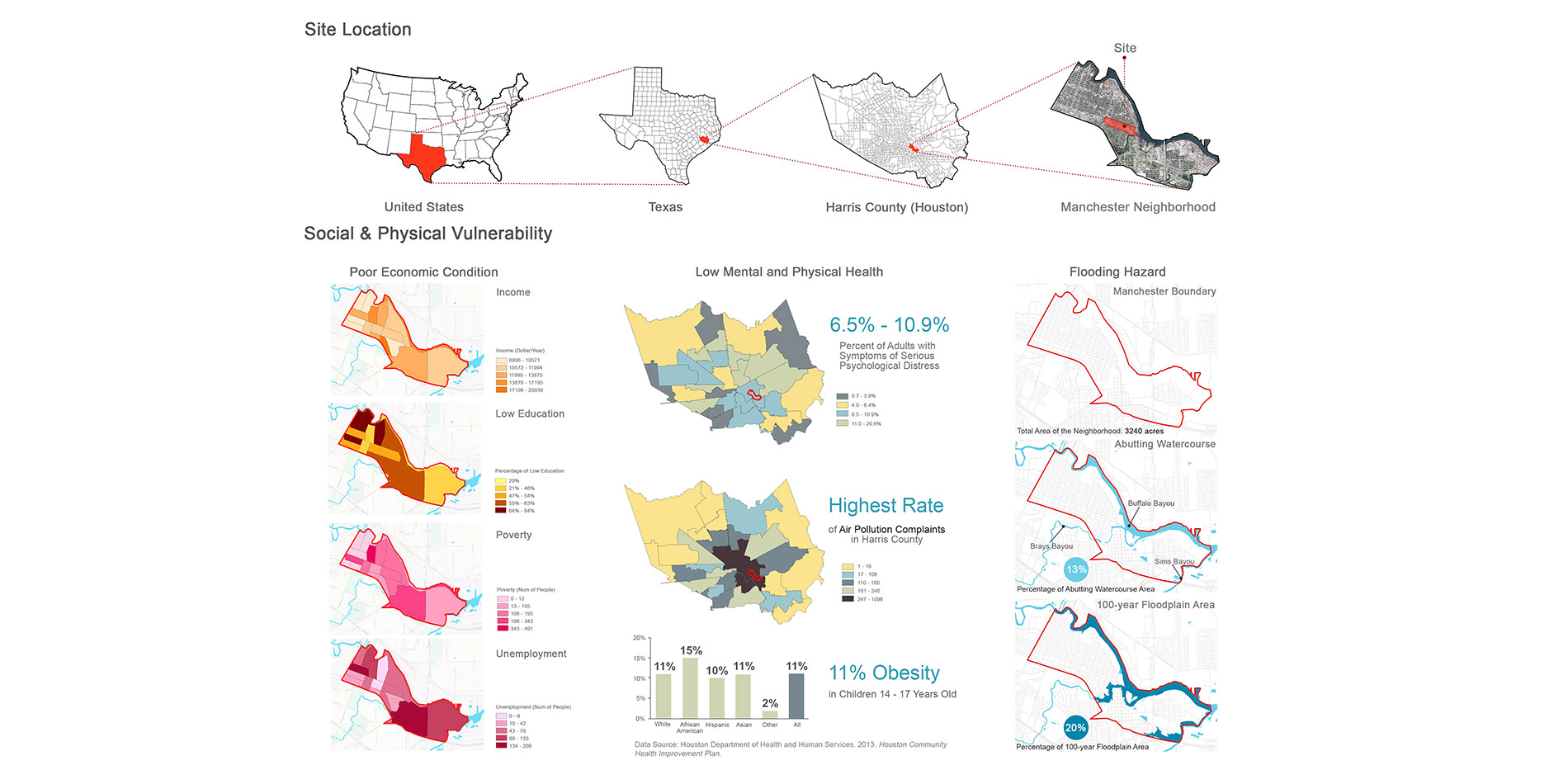
Site Location
Manchester is a neighborhood located southeast of Houston, TX. One of Houston’s oldest neighborhoods, Manchester is surrounded by industries and has one of the highest river impairments and lowest water qualities in the state. It is also one of the most flood prone neighborhoods in the U.S., one where smokestacks grace every backyard view. Local authorities provide sightseeing ventures for outsiders and residents to show how bad the conditions are in the neighborhood, calling them "Toxic Tours." Manchester has a large number of undocumented Hispanic immigrants and a full 1/3 of its residents live below the poverty line. A groundbreaking study by the Houston Chronicle in 2005 revealed that the air pollution in Manchester was “like sitting in traffic 24/7” and that toxin levels “were high enough to trigger a full-scale federal investigation.” Luckily, a grassroots movement by local citizens seeks to help alleviate these issues through connecting with universities, researchers, designers and non-profit organizations. Research and design on these issues were conducted and influenced from a participatory approach in cooperation with the Texas Environmental Justice Advocacy Service (t.e.j.a.s.), Charity Productions and Furr High School’s Green Ambassadors. Green infrastructure, open space planning and community design schemes were developed, assisted by community input through several public engagement sessions. Conceptual master plans were developed and provisions for land use and open space planning, green infrastructure, and hydrological management were generated.
Issues
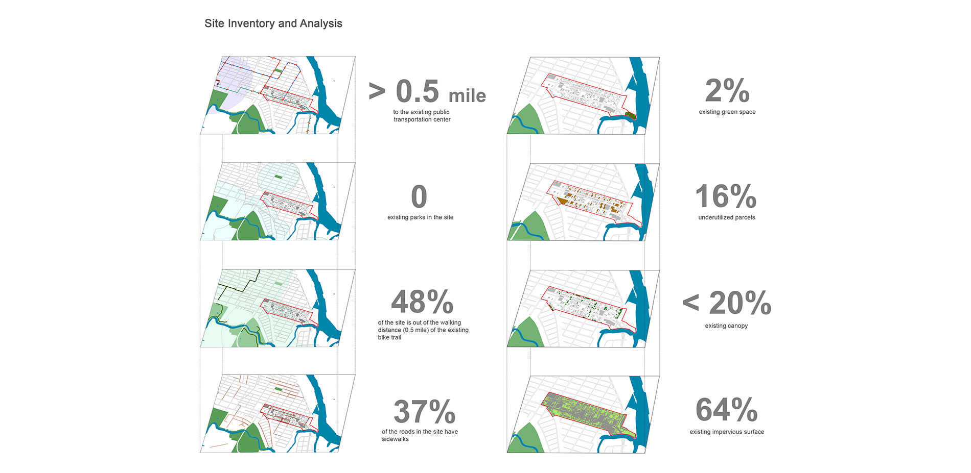
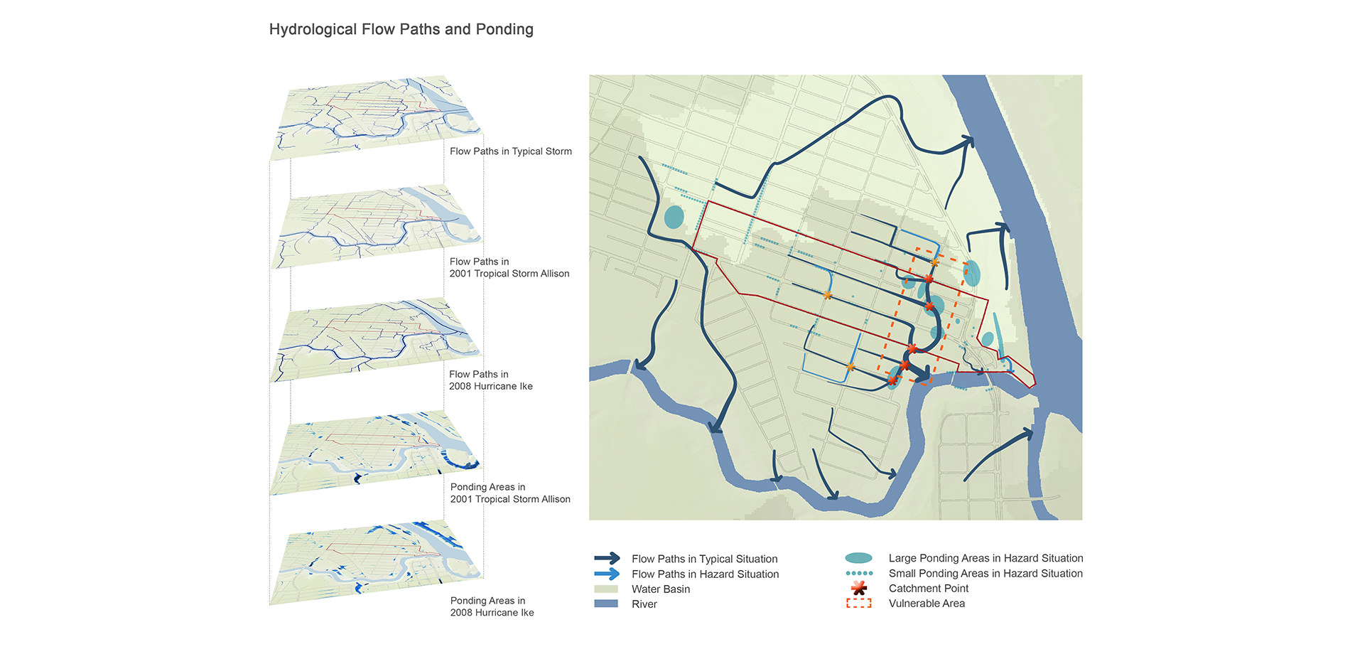
The community faces three main issues: low-income demographics, poor health of residents and flooding hazards. Because Manchester is identified a flood vulnerable neighborhood, the project sought to provide growth options to address this issue while minimizing the displacement of existing residents and increasing job opportunities per acre. 68% of the neighborhood’s surface is currently impervious and the significant lack of open space makes the current infrastructure ineffective in preventing flooding from both frequent and large storms. As shown in the recent Houston floods, increases in impervious surfaces due to development in flood susceptible areas can exacerbate flooding issues, as there is less non-developed space to allow for absorption and infiltration. Protecting open space in flood prone areas is used to significantly reduce the adverse effects of floods. Local parks, playing fields, green infrastructure and undeveloped lands act as a storm buffers to surrounding properties as well as potential places for social interaction.
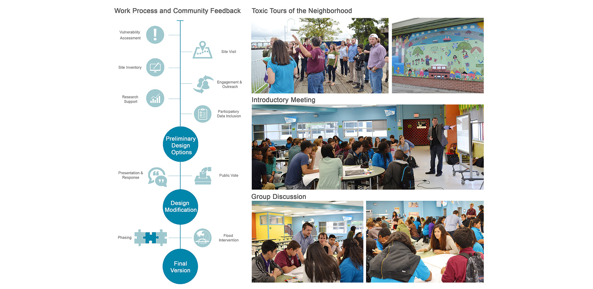
Participatory Process
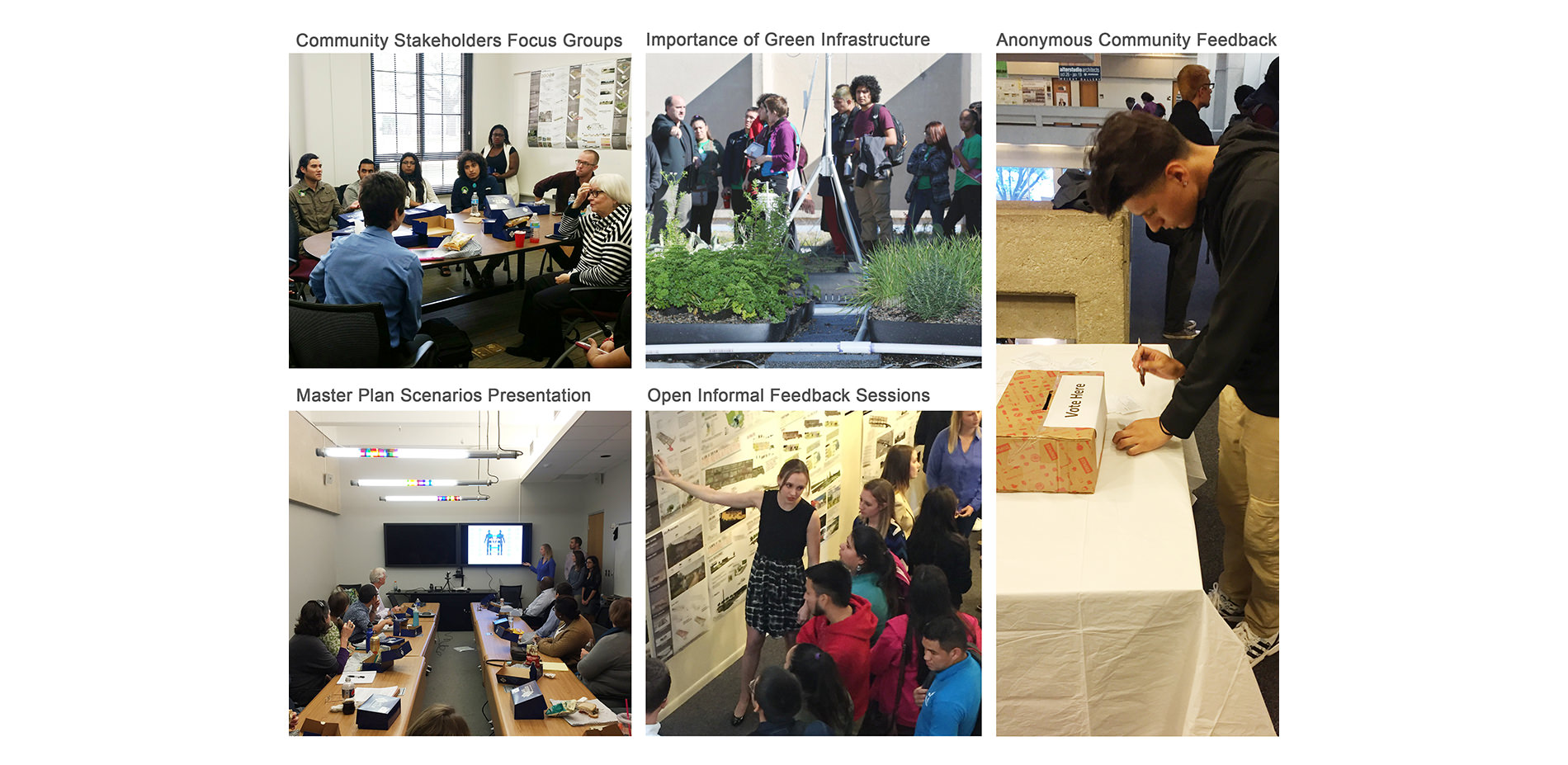
Participatory involvement was initiated four times within a five month period. First, an introductory meeting allowed residents to specify the boundary in which the site investigation would occur and a discussion of on-site problems took place. This assisted in both helping identify areas of pooling and flowing of floodwaters as well as identifying flood vulnerable areas. Identified issues were to be treated through low impact, evidence-based design. A second meeting involved a presentation to the community of the initial site analysis findings. Feedback from the community provided further insight to identified conditions as well as ideas for future functions to be incorporated into a conceptual master plan. A third and fourth meeting involved a feedback loop between community members and designers in which a series of master plan scenarios were presented and critiqued by neighborhood members. Responses from the community to the designers were then utilized to condense the scenarios into one singular revised plan, which was then then re-presented to the community.
The top 5 things community members requested included green space, drainage structure, recreational space, an educational center and lakes/ponds, while the top 5 things listed to remove included unused parking lots, impervious surfaces, abandoned structures, litter and chain restaurants. The design was able to incorporate information provided by the community which helped to 1) help inventory and locate flood-prone areas and on-site problems, 2) spatially locate potential new land uses, 3) develop desired functions for proposed open spaces and recreational activities and 4) suggest new job opportunities for enhancing the local economy, resulting in a citizen driven, user influenced urban design scheme.
Design Goals
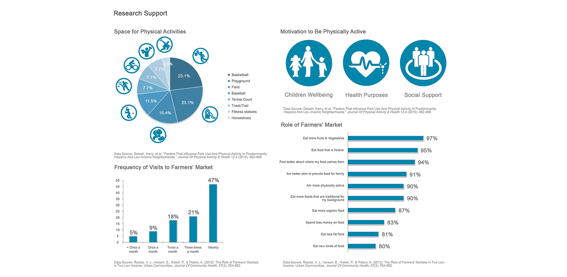
The final design has three goals: 1) Increase the local economy, 2) Create a healthier and more active neighborhood and 3) Strengthen the flood resilience. Research focusing on the relationship of community space to physical behavior was also conducted to support the design program. The literature illustrates that basketball courts, playgrounds and recreational trails increases usage of outdoor activities; motivation for continued use of these spaces includes playing with children, keeping healthy and increasing social communication. In addition market access plays a critical role in Hispanic communities, increasing access to more fresh and healthy foods.
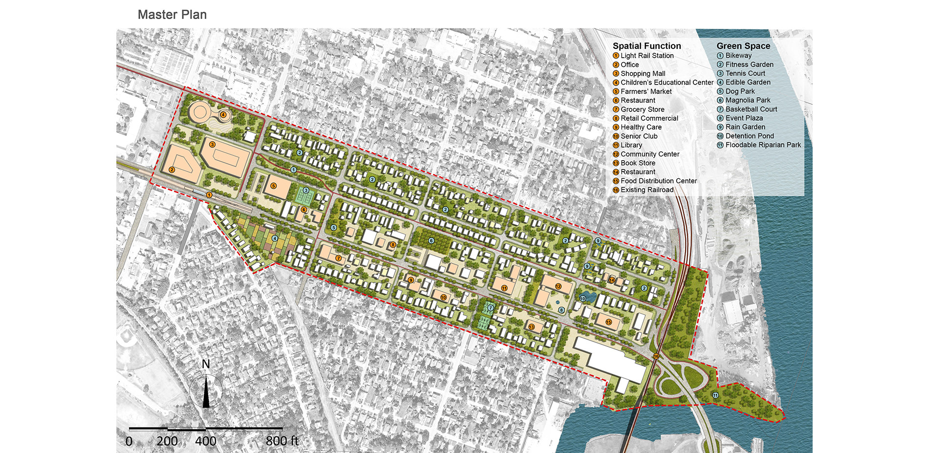
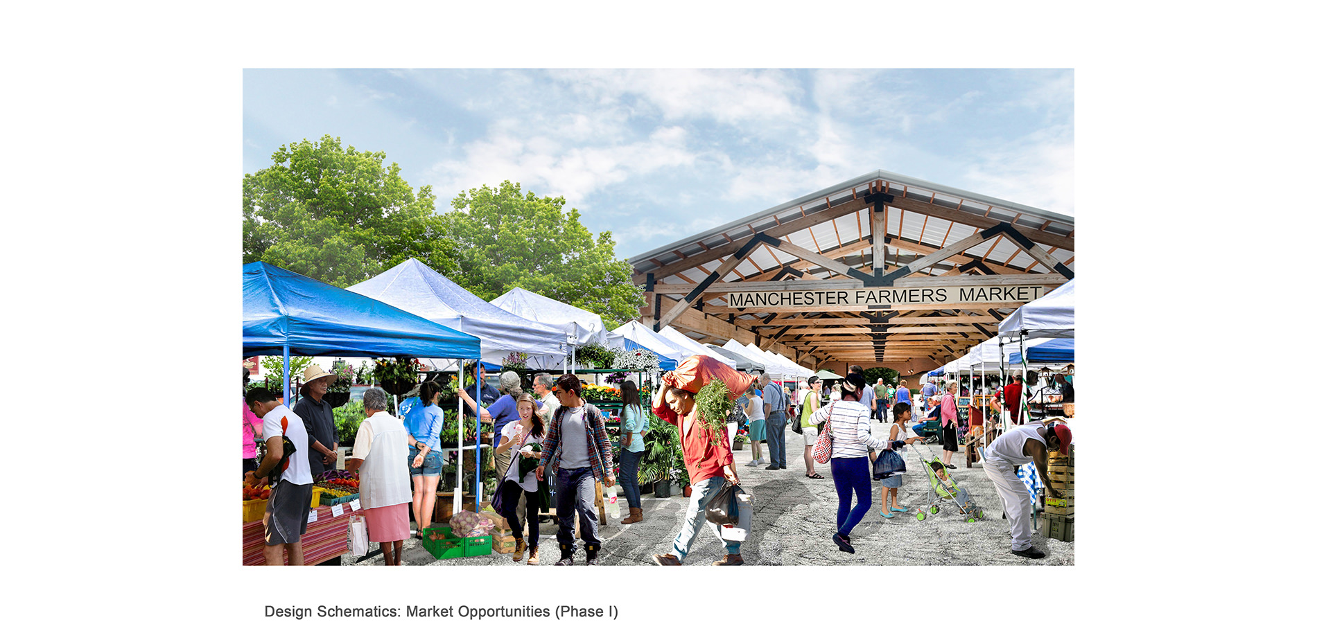
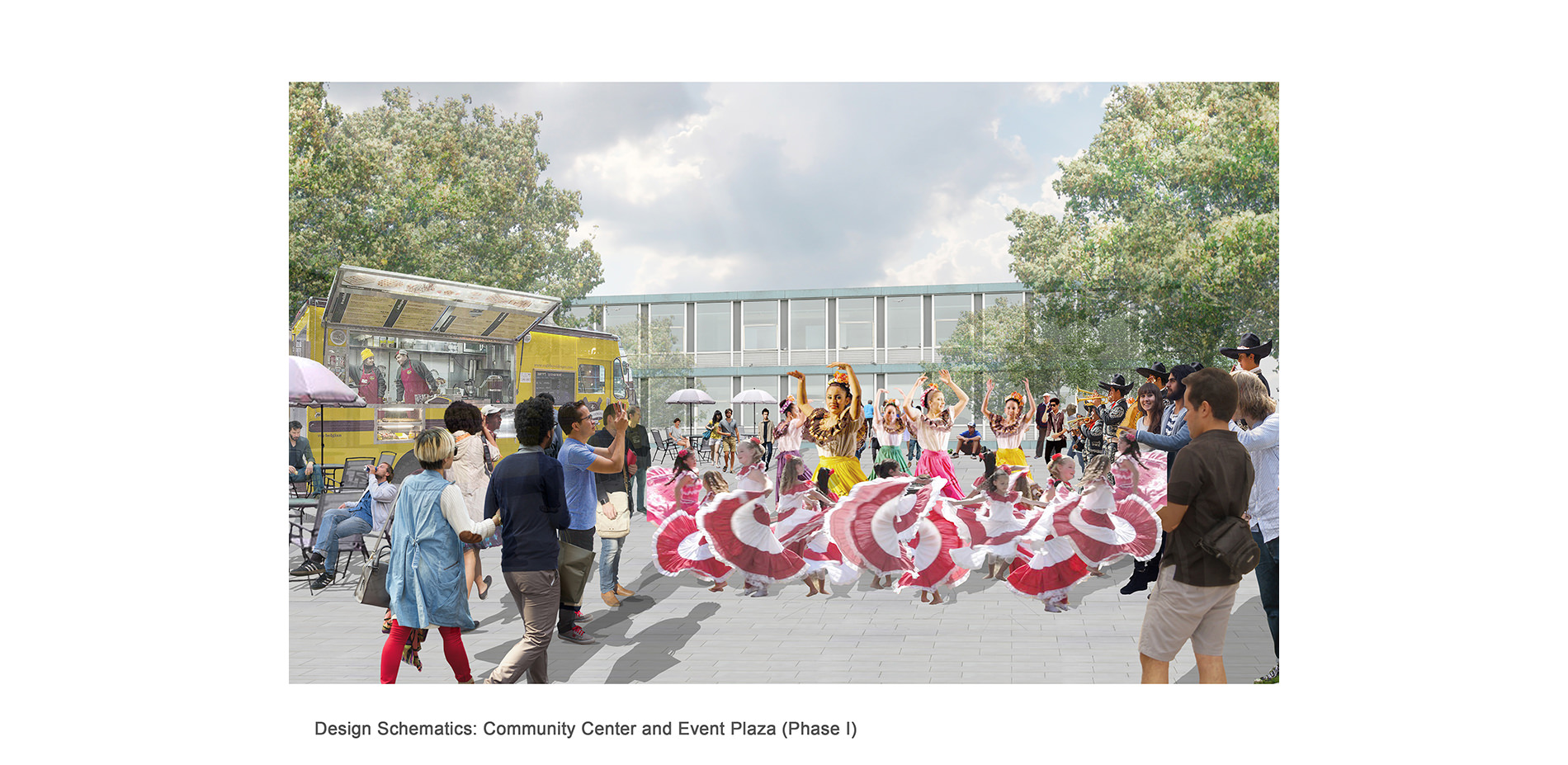
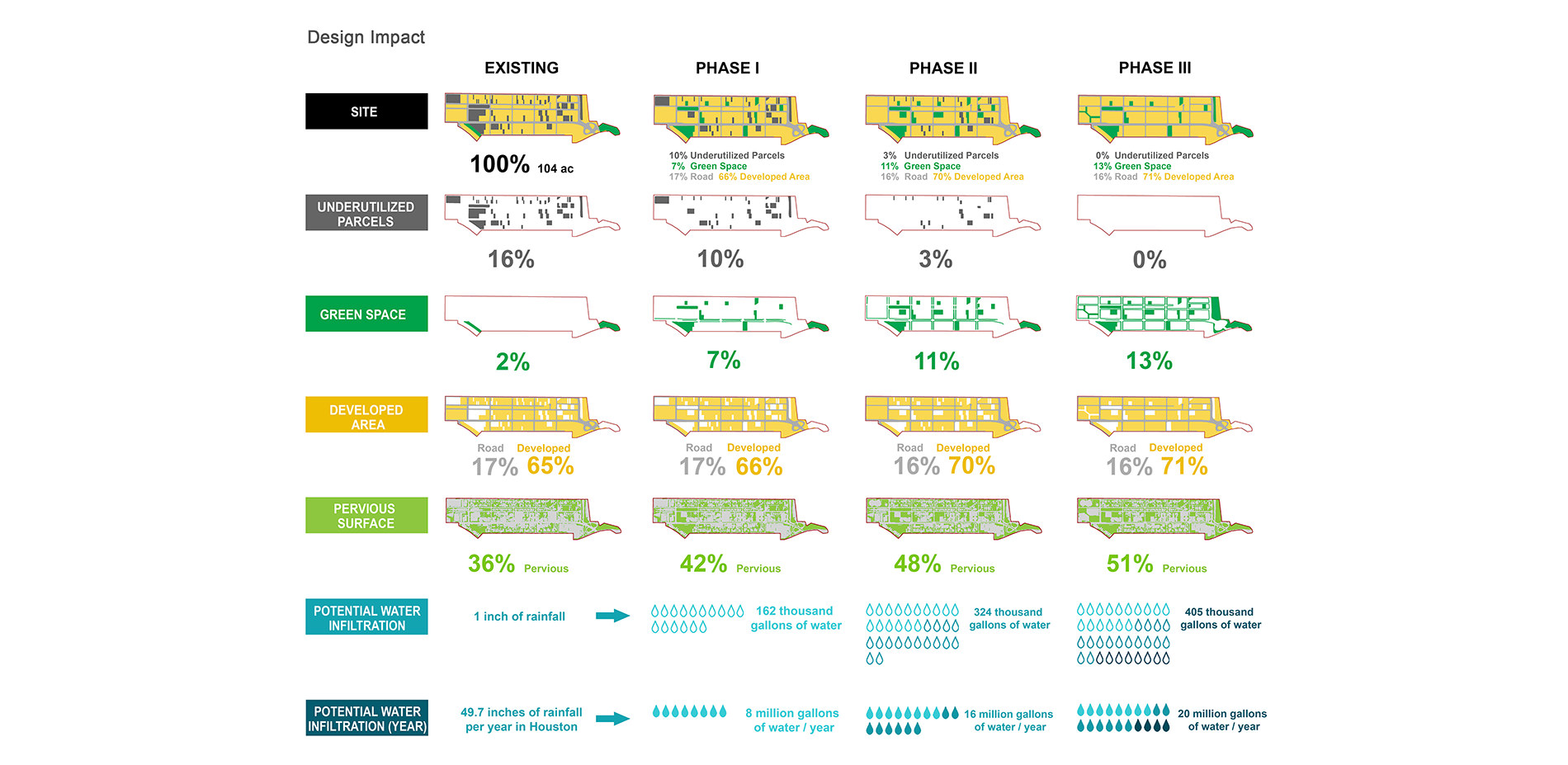
The site has 16% underutilized area – vacant parcels/abandoned structures. Much of this area was repurposed as green infrastructure or job opportunities. Based on the community and research support, functionality of green spaces includes event space, recreational opportunities, edible gardens, parks and stormwater management. The market allows for local opportunities to sell crafts and goods. Each residential block was incorporated with its own fitness garden, which was retrofitted into existing vacant parcels. To satisfy the demand of various age groups, more community support services were also designed into the community’s vision, including: a community center, a children playing center, a senior club, health care facilities, a book store, and a library. A food distribution center is also proposed to encourage the clean industry and create a stable jobs source.
Design Program and Impact
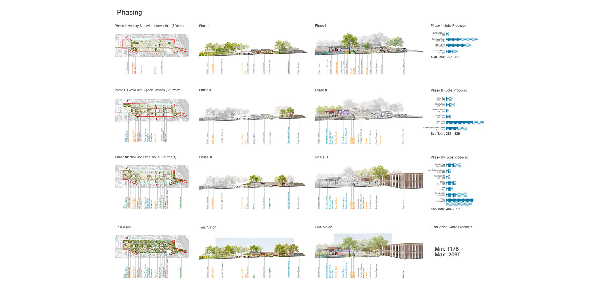
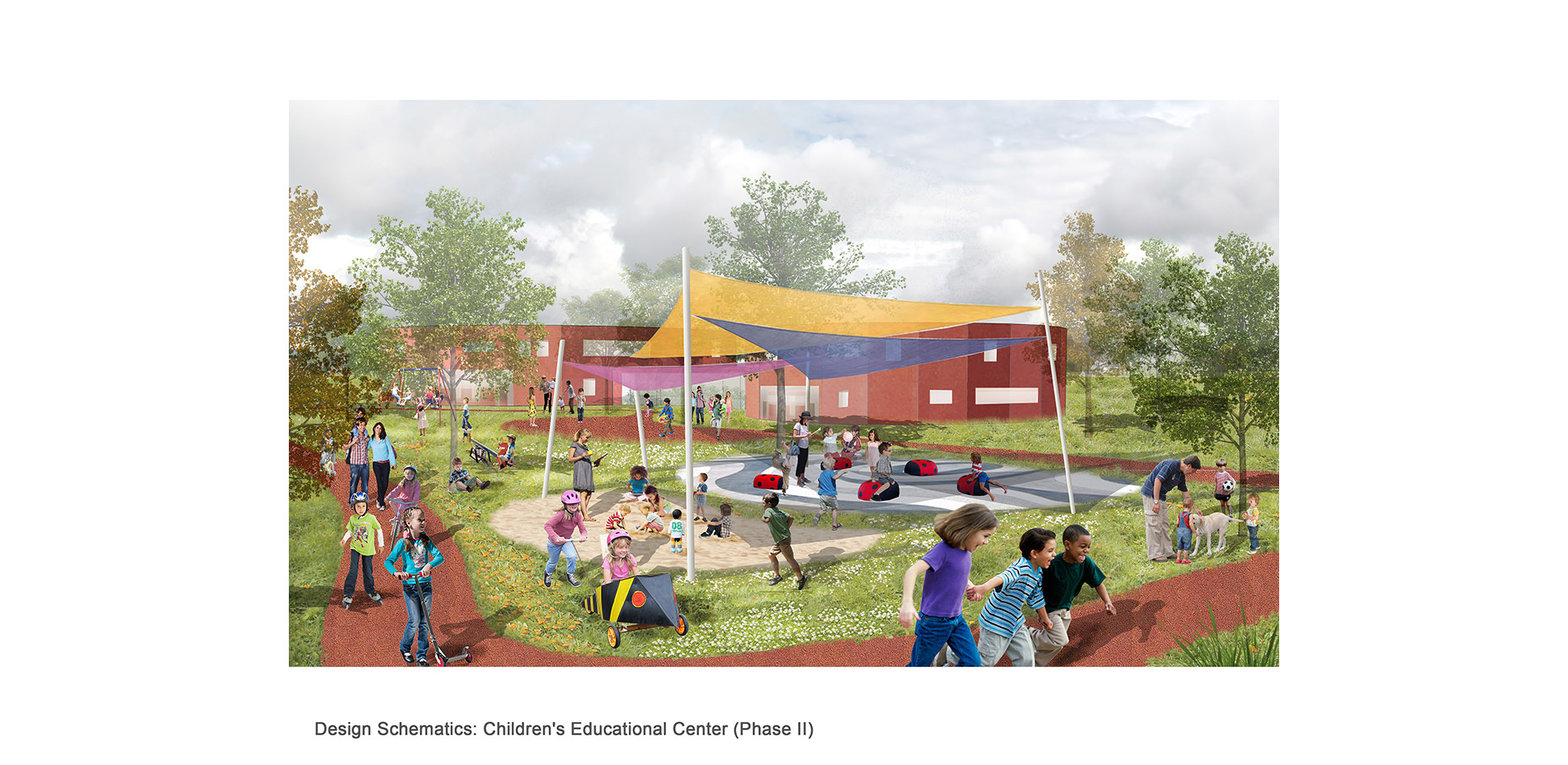
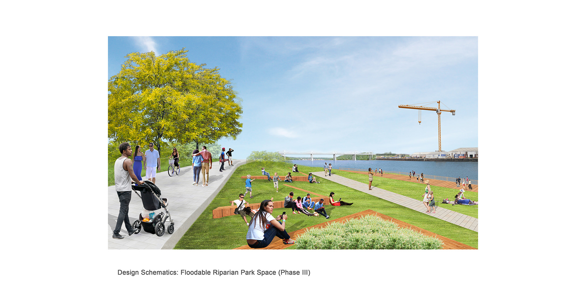
The design is to be implemented in three phases. The first phase focuses on the intervention of healthy behavior to help solve health issues and create a green infrastructure skeleton to mitigate flooding issues. The market and community center are two anchors put in place to spur development for future phases and increase communication in the neighborhood and strengthen residents' belonging to the community. The market and edible garden provide critical green space while creating jobs for residents. Event spaces and the community center provide a site for residents to hold their traditional cultural celebrations/festivals. The new programs in phase one will produce around 300 - 540 jobs. Phase two focuses on community support facilities. Streetscape improvements and new stormwater mitigation facilities to counteract effects of proposed development will be implemented. The new programs will create about 380 - 640 job opportunities. Phase three focuses on maximizing new job creation. A new library and book store will be built in this period to improve the low education condition. New local, cleaner industries such as a large food distribution center are also projected.
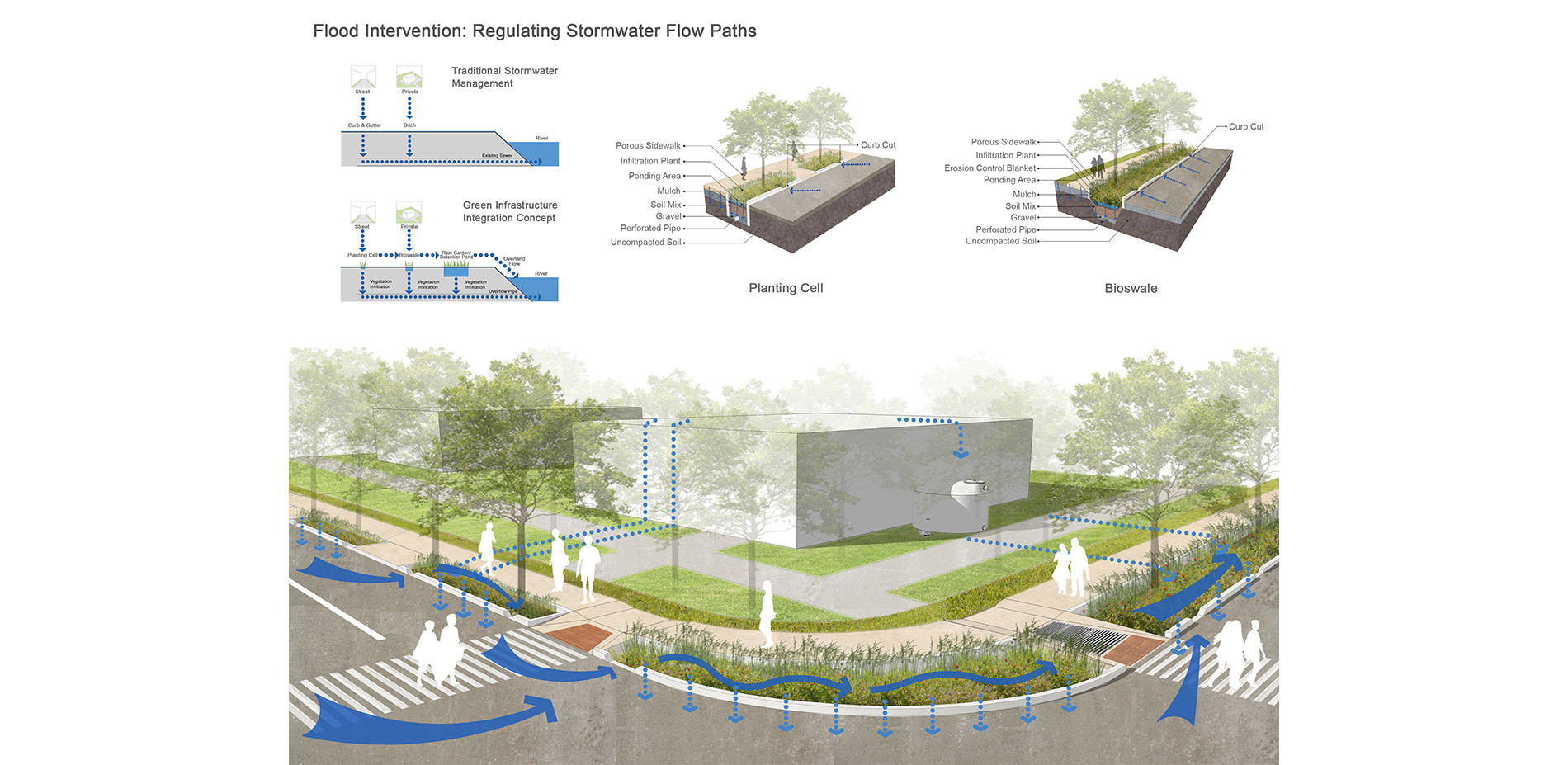
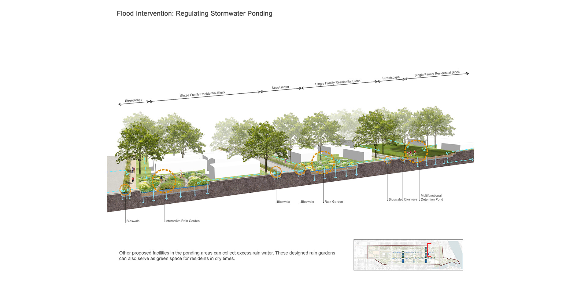
Because the flow paths and ponding areas of stormwater were primarily located on the streets, streetscape amenities to deal with flooding issues were of primary concern. Currently, insufficient gutters and sewers are used to collect stormwater. A series of low impact stormwater mitigation techniques are proposed along the roadways to collect stormwater. Curb cuts are also strategically located to direct the water to flow into bioswales along the streets. Excess rain water that cannot be collected will be directed into the other proposed facilities as part of a flood attenuation system. These are designed as rain gardens which can serve as green space for residents in dry times.
After the design is implemented, a majority of the existing underutilized parcels will be regenerated. Simultaneously, the amount of green space will increase nearly seven times its current amount while the percentage of pervious surface will increase from 36% to 51%. This change will strengthen the capability of water infiltration. Houston has 49.7 inch rainfall per year and the site projects to infiltrate up to an additional 20 million gallons of water per year, at maximum capacity.